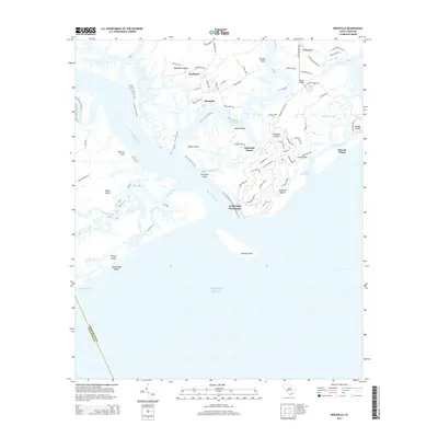
2014 Map of Rockville
USGS Topo · Published 2014About this map
Wadmalaw Island and the surrounding Sea Islands define this coastal landscape, where the tidal waters of the North Edisto River and Bohicket Creek meet the Atlantic Ocean. The historic village of Rockville sits at the southern tip of the island, characterized by a grid of local roads like Rockland Ave and Cherry Point Rd. To the east, Seabrook Island and Kiawah Island show modern residential development and managed lands, including Camp Saint Christopher near Seabrook Beach.
Find a feature on this map
76 named features on this map. Tap any name to fly to it.
Don’t see what you’re looking for? This feature index may not catch every label — zoom into the map to look around manually.
Map Details
Editions of this 2014 Rockville Map
This is the sole edition of this map. No revisions or reprints were ever made.
Other maps of this area

1918 · Kiawah Island
USGS Topo · 1:21,120

1919 · Edisto Island
USGS Topo · 1:62,500

1919 · Wadmelaw Island
USGS Topo · 1:62,500

1919 · Legareville
USGS Topo · 1:21,120

1920 · St. Helena Sound
USGS Topo · 1:62,500

1943 · Legareville
USGS Topo · 1:24,000

1943 · Edisto Island
USGS Topo · 1:62,500

1943 · Kiawah Island
USGS Topo · 1:24,000

1944 · Wadmelaw Island
USGS Topo · 1:62,500

1947 · Savannah
USGS Topo · 1:250,000