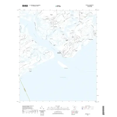
2020 Map of Rockville
USGS Topo · Published 2020About this map
Wadmalaw Island and the neighboring sea islands define this maritime landscape where the North Edisto River meets the Atlantic Ocean. The historic village of Rockville remains a central point of interest, situated along Bohicket Creek near the older settlement of Rockland. This modern survey illustrates the coastal development patterns on Seabrook Island and the southwestern edge of Kiawah Island, contrasted with the managed lands of the Greenway Plantation Pond on Edisto Island. Significant for its coastal morphology, the map details the shifting sands and watercourses of Captain Sams Inlet and the Deveaux Bank. Historical sites like Camp Saint Christopher and the Point of Pines are clearly marked, alongside infrastructure such as the Andell Bridge connecting the islands to Johns Island.
Find a feature on this map
89 named features on this map. Tap any name to fly to it.
Don’t see what you’re looking for? This feature index may not catch every label — zoom into the map to look around manually.
Map Details
Editions of this 2020 Rockville Map
This is the sole edition of this map. No revisions or reprints were ever made.
Other maps of this area

1918 · Kiawah Island
USGS Topo · 1:21,120

1919 · Edisto Island
USGS Topo · 1:62,500

1919 · Wadmelaw Island
USGS Topo · 1:62,500

1919 · Legareville
USGS Topo · 1:21,120

1920 · St. Helena Sound
USGS Topo · 1:62,500

1943 · Legareville
USGS Topo · 1:24,000

1943 · Edisto Island
USGS Topo · 1:62,500

1943 · Kiawah Island
USGS Topo · 1:24,000

1944 · Wadmelaw Island
USGS Topo · 1:62,500

1947 · Savannah
USGS Topo · 1:250,000