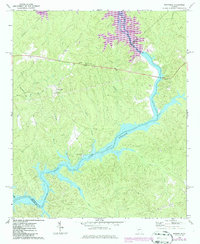
1972 Map of Rockville
USGS Topo · Published 1986About this map
Rockville serves as the focal point of this rural landscape, situated near the confluence of the Oconee River and the expanding waters of Lake Sinclair. The settlement pattern in this corner of Putnam County is defined by its small community centers and country churches, including St Pauls Ch and Mt Zion Ch. To the north, the emergence of Lake Oconee is noted by revisions to the terrain where Greene, Hancock, and Putnam Counties meet. This survey provides a precise look at the transition from traditional woodland and creek-bottom farming to a reservoir-dominated environment. Notable local landmarks like the Rockville Lookout Tower and Jenkins Grove Chapel stand alongside numerous smaller tributaries such as Sandy Run and Cattail Branch, illustrating the area's intricate drainage before the river's character was permanently altered by downstream impoundments.
Find a feature on this map
22 named features on this map. Tap any name to fly to it.
Don’t see what you’re looking for? This feature index may not catch every label — zoom into the map to look around manually.
Map Details
Editions of this 1972 Rockville Map
2 editions found
Other maps of this area

1912 · Milledgeville
USGS Topo · 1:62,500

1953 · Athens
USGS Topo · 1:250,000

1958 · Athens
USGS Topo · 1:250,000

1959 · Athens
USGS Topo · 1:250,000

1963 · Athens
USGS Topo · 1:250,000

1972 · Liberty
USGS Topo · 1:24,000

1972 · Shoulderbone
USGS Topo · 1:24,000

1972 · Meda
USGS Topo · 1:24,000

1972 · Harmony
USGS Topo · 1:24,000
1972 · Devereux
USGS Topo · 1:24,000