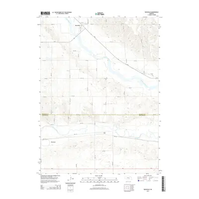
2014 Map of Rockville
USGS Topo · Published 2014About this map
Middle Loup River and the South Loup River dominate this central Nebraska landscape, defining the geographic orientation of the settlements here. In the north, Rockville sits near the confluence of Rock Cr and the larger Loup, while the southern portion of the quadrangle includes the northern edges of Ravenna. The terrain between these waterways is characterized by the upland divides of the Sherman and Buffalo county line, where local landmarks like Noble Field and Hayestown Cem are established. Transportation follows the river valleys and a structured section-line grid, with Ne-58 cutting diagonally through the drainage basins to connect the rural communities. These water systems were critical to the development of the region's agricultural layout, influencing the placement of the Soulville Cem and the various county roads that cross the prairie.
Find a feature on this map
24 named features on this map. Tap any name to fly to it.
Don’t see what you’re looking for? This feature index may not catch every label — zoom into the map to look around manually.
Map Details
Editions of this 2014 Rockville Map
This is the sole edition of this map. No revisions or reprints were ever made.
Other maps of this area

1895 · Wood River
USGS Topo · 1:62,500

1896 · Wood River
USGS Topo · 1:125,000

1899 · Loup
USGS Topo · 1:125,000

1953 · Rockville
USGS Topo · 1:24,000

1953 · Boelus
USGS Topo · 1:24,000

1953 · Ravenna NW
USGS Topo · 1:24,000

1953 · Farwell
USGS Topo · 1:24,000

1953 · Ashton
USGS Topo · 1:24,000

1953 · Ravenna
USGS Topo · 1:24,000

1955 · Broken Bow
USGS Topo · 1:250,000