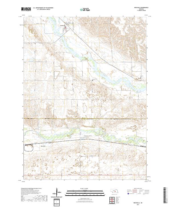
2021 Map of Rockville
USGS Topo · Published 2021About this map
The Middle Loup River and South Loup River dominate this Central Nebraska landscape, flowing roughly parallel through a region defined by the transition from river valleys to the surrounding uplands. On the northern banks of the Middle Loup, Rockville is oriented around Railroad Ave and Ley St, while the town of Ravenna sits further south along the lower river. The topography here reflects the ancient alluvial and aeolian processes of the Platte River basin, with many small intermittent drainages and draws cutting through the loess hills between the river corridors.
Find a feature on this map
40 named features on this map. Tap any name to fly to it.
Don’t see what you’re looking for? This feature index may not catch every label — zoom into the map to look around manually.
Map Details
Editions of this 2021 Rockville Map
This is the sole edition of this map. No revisions or reprints were ever made.
Other maps of this area

1895 · Wood River
USGS Topo · 1:62,500

1896 · Wood River
USGS Topo · 1:125,000

1899 · Loup
USGS Topo · 1:125,000

1953 · Rockville
USGS Topo · 1:24,000

1953 · Boelus
USGS Topo · 1:24,000

1953 · Ravenna NW
USGS Topo · 1:24,000

1953 · Farwell
USGS Topo · 1:24,000

1953 · Ashton
USGS Topo · 1:24,000

1953 · Ravenna
USGS Topo · 1:24,000

1955 · Broken Bow
USGS Topo · 1:250,000