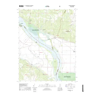
2018 Map of Rockwood
USGS Topo · Published 2018About this map
Rockwood sits along the shifting banks of the Mississippi River, where the Illinois and Missouri borders meet near the Middle Mississippi River National Wildlife Refuge. This landscape is defined by the river's dynamic hydrology, evidenced by features like Rockwood Island, Liberty Bar, and Potato Bend. To the west, the Missouri side includes the small settlements of Menfro, Point Rest, and Bois Brule, connected by a network of Perry County roads such as PCR 356.
Find a feature on this map
85 named features on this map. Tap any name to fly to it.
Don’t see what you’re looking for? This feature index may not catch every label — zoom into the map to look around manually.
Map Details
Editions of this 2018 Rockwood Map
This is the sole edition of this map. No revisions or reprints were ever made.
Other maps of this area

1915 · Chester
USGS Topo · 1:62,500

1916 · Campbell Hill
USGS Topo · 1:62,500

1918 · Altenburg
USGS Topo · 1:62,500

1918 · Campbell Hill
USGS Topo · 1:62,500

1923 · Perryville
USGS Topo · 1:62,500

1924 · Perryville
USGS Topo · 1:62,500

1925 · Altenburg
USGS Topo · 1:62,500

1947 · Chester
USGS Topo · 1:62,500

1947 · Crosstown
USGS Topo · 1:24,000

1947 · Altenburg
USGS Topo · 1:62,500