1969 Map of Rockwood
USGS Topo · Published 1971About this map
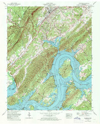
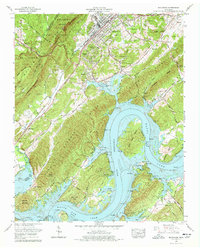
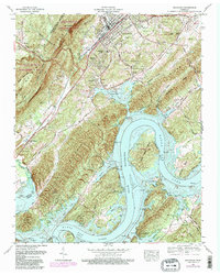
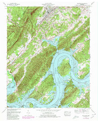
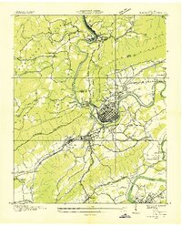
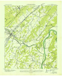
Watts Bar Lake and the Tennessee River dominate this 1969 topographic survey, where the water levels meet the steep base of the Cumberland Escarpment. The settlement of Rockwood is situated at the crossroads of the Southern Railway and the Walton Road, reflecting its importance as a local hub. The landscape is dotted with small family and community cemeteries such as Honeycutt Cem, Newsome Cem, and Odd Fellows Cem, providing a detailed record for genealogists. Along the river, Thief Neck Island sits as a prominent feature near Buck Toms Scout Camp and Camp John Knox. The presence of several Indian mounds near the riverbanks points to a deep history of habitation long before the modernization of the shoreline and the development of lakeside communities like Lakemont Heights and Apollo Shores.
Find a feature on this map
86 named features on this map. Tap any name to fly to it.
Don’t see what you’re looking for? This feature index may not catch every label — zoom into the map to look around manually.
Map Details
Editions of this 1969 Rockwood Map
4 editions found
Other maps of this area

1887 · Kingston
USGS Topo · 1:125,000

1891 · Kingston
USGS Topo · 1:125,000

1893 · Kingston
USGS Topo · 1:125,000

1935 · Rockwood
USGS Topo · 1:24,000
1935 · Harriman
USGS Topo · 1:24,000

1936 · Roddy
USGS Topo · 1:24,000

1936 · Ozone
USGS Topo · 1:24,000

1936 · Cardiff
USGS Topo · 1:24,000
1936 · Spring City
USGS Topo · 1:24,000

1936 · Pattie Gap
USGS Topo · 1:24,000