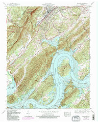
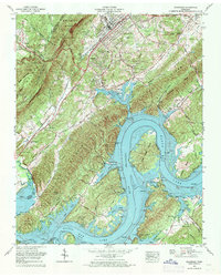
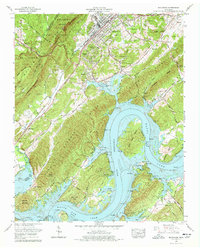
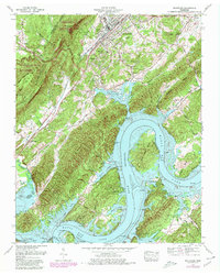
1969 Map of Rockwood
USGS Topo · Published 1980About this map
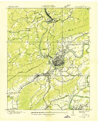
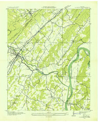
Cumberland Ridge and the Cumberland Escarpment dominate the western landscape, rising sharply above the developed corridor of Rockwood. This industrial and transport hub is defined by the intersection of the Southern RR and the Cincinnati New Orleans and Texas Pacific RR, which facilitated the movement of goods from local operations like the quarry. Beyond the city center, the terrain transitions into agricultural valleys and the sprawling waters of Watts Bar Lake, where Thief Neck Island sits within the ancient bends of the Tennessee River.
Find a feature on this map
76 named features on this map. Tap any name to fly to it.
Don’t see what you’re looking for? This feature index may not catch every label — zoom into the map to look around manually.
Map Details
Editions of this 1969 Rockwood Map
4 editions found
Other maps of this area

1887 · Kingston
USGS Topo · 1:125,000

1891 · Kingston
USGS Topo · 1:125,000

1893 · Kingston
USGS Topo · 1:125,000

1935 · Rockwood
USGS Topo · 1:24,000
1935 · Harriman
USGS Topo · 1:24,000

1936 · Roddy
USGS Topo · 1:24,000

1936 · Ozone
USGS Topo · 1:24,000

1936 · Cardiff
USGS Topo · 1:24,000
1936 · Spring City
USGS Topo · 1:24,000

1936 · Pattie Gap
USGS Topo · 1:24,000