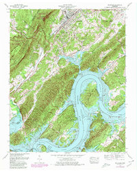
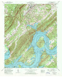
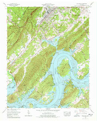
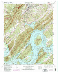
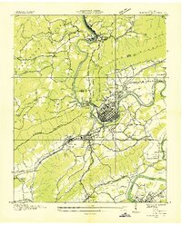
1969 Map of Rockwood
USGS Topo · Published 1980About this map
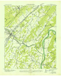
Watts Bar Lake dominates the eastern half of this landscape, where the wide Tennessee River winds around Thief Neck Island and through Long Bend. This 1969 survey, photorevised in 1980, captures a region shaped by both its steep topography and modern hydroelectric development. The Cumberland Escarpment and Cumberland Ridge rise sharply to the west, providing a natural barrier that frames Abes Valley.
Find a feature on this map
76 named features on this map. Tap any name to fly to it.
Don’t see what you’re looking for? This feature index may not catch every label — zoom into the map to look around manually.
Map Details
Editions of this 1969 Rockwood Map
4 editions found
Other maps of this area

1887 · Kingston
USGS Topo · 1:125,000

1891 · Kingston
USGS Topo · 1:125,000

1893 · Kingston
USGS Topo · 1:125,000

1935 · Rockwood
USGS Topo · 1:24,000
1935 · Harriman
USGS Topo · 1:24,000

1936 · Roddy
USGS Topo · 1:24,000

1936 · Ozone
USGS Topo · 1:24,000

1936 · Cardiff
USGS Topo · 1:24,000
1936 · Spring City
USGS Topo · 1:24,000

1936 · Pattie Gap
USGS Topo · 1:24,000