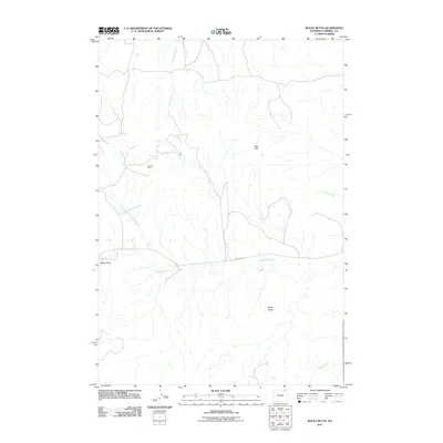
2011 Map of Rocky Butte
USGS Topo · Published 2011About this map
The Ute Oil Field anchors the northwestern portion of this Campbell County terrain, illustrating the industrial footprint on the Wyoming landscape during the early 21st century. The area is defined by a complex drainage network, including the Rock Creek headwaters and the North Fork Olmstead Creek, which carve through the high plains toward the Olmstead Creek main stem. Notable landmarks like the Red Hills and the namesake Rocky Butte rise above the surrounding draws. Transport in this isolated ranching and energy-producing region is primarily facilitated by Olmstead Rd, which skirts the southern reaches of the Daley Draw. This survey captures the sparse settlement and resource-driven land use characteristic of the Powder River Basin's eastern margins.
Find a feature on this map
10 named features on this map. Tap any name to fly to it.
Don’t see what you’re looking for? This feature index may not catch every label — zoom into the map to look around manually.
Map Details
Editions of this 2011 Rocky Butte Map
This is the sole edition of this map. No revisions or reprints were ever made.
Other maps of this area

1954 · Ekalaka
USGS Topo · 1:250,000

1954 · Gillette
USGS Topo · 1:250,000

1955 · Gillette
USGS Topo · 1:250,000

1956 · Ekalaka
USGS Topo · 1:250,000

1958 · Gillette
USGS Topo · 1:250,000

1958 · Ekalaka
USGS Topo · 1:250,000

1962 · Gillette
USGS Topo · 1:250,000

1965 · Ekalaka
USGS Topo · 1:250,000

1970 · Wild Bill Creek
USGS Topo · 1:24,000
1970 · Biddle
USGS Topo · 1:24,000