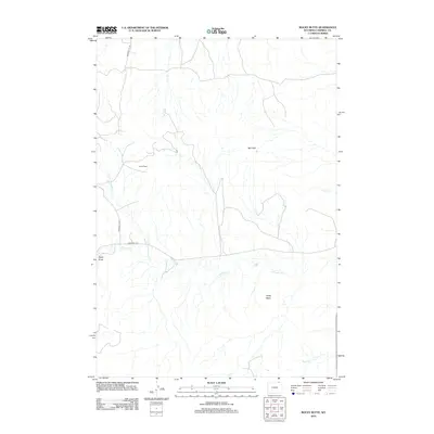
2012 Map of Rocky Butte
USGS Topo · Published 2012About this map
Ute Oil Field defines much of the industrial character in this portion of Campbell County, where energy extraction intersects with a landscape of high plains drainage systems. The terrain is marked by prominent landforms such as Rocky Butte and the Red Hills, which overlook a network of seasonal watercourses including Rock Cr and the various branches of Olmstead Cr. These creeks, along with Daley Draw, create a complex topography of erosional features common to the Powder River Basin. Transportation in this area is primarily served by local routes like Bowers Ute Rd and Olmstead Rd, providing access to the distributed infrastructure of the oil field. The map illustrates the sparse, utilitarian settlement pattern typical of Wyoming's mineral-rich ranchlands in the early 21st century.
Find a feature on this map
11 named features on this map. Tap any name to fly to it.
Don’t see what you’re looking for? This feature index may not catch every label — zoom into the map to look around manually.
Map Details
Editions of this 2012 Rocky Butte Map
This is the sole edition of this map. No revisions or reprints were ever made.
Other maps of this area

1954 · Ekalaka
USGS Topo · 1:250,000

1954 · Gillette
USGS Topo · 1:250,000

1955 · Gillette
USGS Topo · 1:250,000

1956 · Ekalaka
USGS Topo · 1:250,000

1958 · Gillette
USGS Topo · 1:250,000

1958 · Ekalaka
USGS Topo · 1:250,000

1962 · Gillette
USGS Topo · 1:250,000

1965 · Ekalaka
USGS Topo · 1:250,000

1970 · Wild Bill Creek
USGS Topo · 1:24,000
1970 · Biddle
USGS Topo · 1:24,000