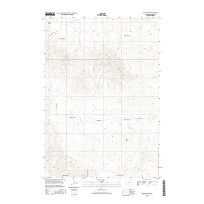
2015 Map of Rocky Butte
USGS Topo · Published 2015About this map
Rocky Butte rises as a prominent landmark in this portion of Campbell County, where the high plains terrain is defined by a network of seasonal drainages and named draws. In this cattle-country landscape, Olmstead Rd and Bowers Ute Rd provide the primary transit through a series of significant geological formations. The geography is characterized by the Red Hills and the winding course of Olmstead Cr, along with its northern branch, the N Fork Olmstead Cr. To the north, Coal Gulch hints at the region's underlying mineral potential, while Rock Cr and Corral Cr drain the eastern slopes. This 2015 survey illustrates the modern configuration of section lines and range boundaries that still govern this sparsely populated ranching territory.
Find a feature on this map
17 named features on this map. Tap any name to fly to it.
Don’t see what you’re looking for? This feature index may not catch every label — zoom into the map to look around manually.
Map Details
Editions of this 2015 Rocky Butte Map
This is the sole edition of this map. No revisions or reprints were ever made.
Other maps of this area

1954 · Ekalaka
USGS Topo · 1:250,000

1954 · Gillette
USGS Topo · 1:250,000

1955 · Gillette
USGS Topo · 1:250,000

1956 · Ekalaka
USGS Topo · 1:250,000

1958 · Gillette
USGS Topo · 1:250,000

1958 · Ekalaka
USGS Topo · 1:250,000

1962 · Gillette
USGS Topo · 1:250,000

1965 · Ekalaka
USGS Topo · 1:250,000

1970 · Wild Bill Creek
USGS Topo · 1:24,000
1970 · Biddle
USGS Topo · 1:24,000