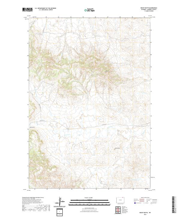
2021 Map of Rocky Butte
USGS Topo · Published 2021About this map
Rocky Butte rises above a high plains landscape defined by its complex network of drainage draws and intermittent creek beds in Campbell County. The topography is dominated by the Red Hills and the winding course of Olmstead Creek, which, along with its North Fork Olmstead Creek, carves through the central portion of the quadrangle. The sparse infrastructure consists primarily of local connectors like Olmstead Rd and Bowers Ute Rd, which follow the contours of the terrain rather than a strict grid.
Find a feature on this map
17 named features on this map. Tap any name to fly to it.
Don’t see what you’re looking for? This feature index may not catch every label — zoom into the map to look around manually.
Map Details
Editions of this 2021 Rocky Butte Map
This is the sole edition of this map. No revisions or reprints were ever made.
Other maps of this area

1954 · Ekalaka
USGS Topo · 1:250,000

1954 · Gillette
USGS Topo · 1:250,000

1955 · Gillette
USGS Topo · 1:250,000

1956 · Ekalaka
USGS Topo · 1:250,000

1958 · Gillette
USGS Topo · 1:250,000

1958 · Ekalaka
USGS Topo · 1:250,000

1962 · Gillette
USGS Topo · 1:250,000

1965 · Ekalaka
USGS Topo · 1:250,000

1970 · Wild Bill Creek
USGS Topo · 1:24,000
1970 · Biddle
USGS Topo · 1:24,000