
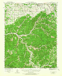
1941 Map of Rocky Comfort
USGS Topo · Published 1962About this map
Rocky Comfort serves as a primary hub within this 1940s landscape, situated where the high plateaus of the Ozarks meet a complex network of valleys. The terrain is deeply incised by the drainage of Big Sugar Creek and Elkhorn Creek, creating a series of named ridges and hollows that defined early settlement patterns. This survey, conducted just before the mid-century, captures the rural density of the era, marked by a high frequency of neighborhood institutions such as Success Sch and Antioch Ch.
Find a feature on this map
93 named features on this map. Tap any name to fly to it.
Don’t see what you’re looking for? This feature index may not catch every label — zoom into the map to look around manually.
Map Details
Editions of this 1941 Rocky Comfort Map
2 editions found
Other maps of this area

1899 · Fayetteville
USGS Topo · 1:125,000

1900 · Eureka Springs
USGS Topo · 1:125,000

1901 · Eureka Springs
USGS Topo · 1:125,000

1901 · Fayetteville
USGS Topo · 1:125,000

1904 · Fayetteville
USGS Topo · 1:125,000

1916 · Neosho
USGS Topo · 1:62,500

1937 · Cassville
USGS Topo · 1:48,000

1940 · Noel
USGS Topo · 1:62,500

1943 · Ritchey
USGS Topo · 1:62,500

1943 · Monett
USGS Topo · 1:62,500