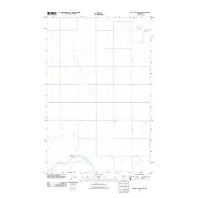
2011 Map of Rocky Coulee SW
USGS Topo · Published 2011About this map
The Marias River winds through the southern reaches of this Hill County landscape, where the high plains are carved by a series of deep drainage channels known as coulees. Notable amongst these is Eightmile Coulee, which feeds into the river valley. The northern terrain is defined by Black Coulee and the presence of Samantha Dam, which serves as a critical water management point for this arid region. The map reflects a modern rural infrastructure, with a grid of section lines and gravel roads such as County Rd 200 S and Hanson Dr providing access to remote agricultural holdings and livestock ranges. This 2011 survey captures the area before further land use shifts, showing the persistent importance of natural and man-made water catchments like Flat Coulee in maintaining the viability of Montana's north-central prairie.
Find a feature on this map
10 named features on this map. Tap any name to fly to it.
Don’t see what you’re looking for? This feature index may not catch every label — zoom into the map to look around manually.
Map Details
Editions of this 2011 Rocky Coulee SW Map
This is the sole edition of this map. No revisions or reprints were ever made.
Other maps of this area

1954 · Shelby
USGS Topo · 1:250,000

1958 · Shelby
USGS Topo · 1:250,000

1969 · Dutch Henry Coulee
USGS Topo · 1:24,000
1969 · Discovery Butte
USGS Topo · 1:24,000

1970 · Poverty Coulee NE
USGS Topo · 1:24,000

1970 · Penzer School
USGS Topo · 1:24,000
1970 · Rocky Coulee SE
USGS Topo · 1:24,000

1970 · Poverty Coulee SE
USGS Topo · 1:24,000

1970 · Rocky Coulee SW
USGS Topo · 1:24,000

1970 · Rocky Coulee
USGS Topo · 1:24,000