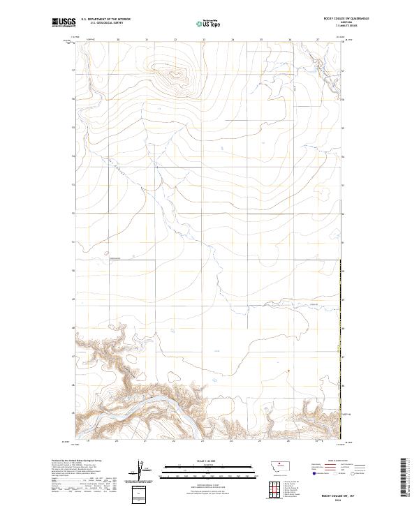
2024 Map of Rocky Coulee SW
USGS Topo · Published 2024About this map
Marias River meanders through the southern portion of this landscape in Hill County, Montana, where deep erosion has carved intricate drainages into the northern plains. This modern survey illustrates how water and access define the territory, with major ephemeral watercourses like Black Coulee, Flat Coulee, and Eightmile Coulee dictating the placement of rural corridors. The infrastructure of the region is linked to local landmarks and ranching operations via Tiber Dam Rd and O'Neil Dr. This map provides a clear view of the t29n r8e and t30n r8e township divisions, showing the enduring grid of the Public Land Survey System against the winding natural path of the river.
Find a feature on this map
11 named features on this map. Tap any name to fly to it.
Don’t see what you’re looking for? This feature index may not catch every label — zoom into the map to look around manually.
Map Details
Editions of this 2024 Rocky Coulee SW Map
This is the sole edition of this map. No revisions or reprints were ever made.
Other maps of this area

1954 · Shelby
USGS Topo · 1:250,000

1958 · Shelby
USGS Topo · 1:250,000

1969 · Dutch Henry Coulee
USGS Topo · 1:24,000
1969 · Discovery Butte
USGS Topo · 1:24,000

1970 · Poverty Coulee NE
USGS Topo · 1:24,000

1970 · Penzer School
USGS Topo · 1:24,000
1970 · Rocky Coulee SE
USGS Topo · 1:24,000

1970 · Poverty Coulee SE
USGS Topo · 1:24,000

1970 · Rocky Coulee SW
USGS Topo · 1:24,000

1970 · Rocky Coulee
USGS Topo · 1:24,000