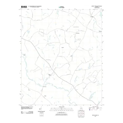
2011 Map of Rocky Ford
USGS Topo · Published 2011About this map
The Ogeechee River snakes through the southern reaches of this Screven County landscape, defining the character of the river-bottom terrain near Rocky Ford. To the north, the settlement of Woodcliff and the smaller community of Thomasboro anchor a grid of rural roads and timbered tracts. The area is particularly dense with small family-named landmarks and cemeteries, providing an excellent resource for researchers tracing local lineages. Features like Finch Cemetery, Daughtry Cemetery, and the curiously named Peggy Zeigler Cemetery Two are interspersed among the drainages of Horse Creek and Mile Branch. Transportation here is primarily rural, with long stretches of Old River Rd N and Rocky Ford Rd connecting these small hubs across the coastal plain. Significant crossings, such as Copps Bridge, illustrate how the local geography dictates the flow of movement around the primary river channel.
Find a feature on this map
53 named features on this map. Tap any name to fly to it.
Don’t see what you’re looking for? This feature index may not catch every label — zoom into the map to look around manually.
Map Details
Editions of this 2011 Rocky Ford Map
This is the sole edition of this map. No revisions or reprints were ever made.
Other maps of this area

1918 · Oliver
USGS Topo · 1:62,500

1920 · Hilltonia
USGS Topo · 1:62,500

1920 · Millen
USGS Topo · 1:62,500

1920 · Oliver
USGS Topo · 1:62,500

1921 · Rocky Ford
USGS Topo · 1:62,500

1943 · Hilltonia
USGS Topo · 1:62,500

1943 · Rocky Ford
USGS Topo · 1:62,500

1943 · Millen
USGS Topo · 1:62,500

1943 · Millen
USGS Topo · 1:125,000

1943 · Oliver
USGS Topo · 1:62,500