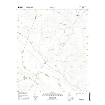
2014 Map of Rocky Ford
USGS Topo · Published 2014About this map
The Ogeechee River and its various tributaries, including Horse Cr, Mile Br, and Douglas Br, define the landscape of this Screven County region. The small settlement of Rocky Ford serves as a local hub near the Ogeechee River crossing at Copps Bridge, while other communities like Woodcliff, Scarboro, Parkers, and Thomasboro are scattered across the agrarian coastal plain. Genealogists will find several family-named burial sites, such as Peggy Zeigler Cem Two, Daughtry Cem, and Finch Cem. The terrain is generally low-lying, featuring landforms like Negro Island and numerous named branches and creeks. Transportation is marked by a network of rural routes, including the Scarboro Hwy and Ga-17, which connect these small rural pockets. Aviation interests are represented by the Pegasus Ranch Airport and its associated Airstrip Rd located south of the Parkers community.
Find a feature on this map
67 named features on this map. Tap any name to fly to it.
Don’t see what you’re looking for? This feature index may not catch every label — zoom into the map to look around manually.
Map Details
Editions of this 2014 Rocky Ford Map
This is the sole edition of this map. No revisions or reprints were ever made.
Other maps of this area

1918 · Oliver
USGS Topo · 1:62,500

1920 · Hilltonia
USGS Topo · 1:62,500

1920 · Millen
USGS Topo · 1:62,500

1920 · Oliver
USGS Topo · 1:62,500

1921 · Rocky Ford
USGS Topo · 1:62,500

1943 · Hilltonia
USGS Topo · 1:62,500

1943 · Rocky Ford
USGS Topo · 1:62,500

1943 · Millen
USGS Topo · 1:62,500

1943 · Millen
USGS Topo · 1:125,000

1943 · Oliver
USGS Topo · 1:62,500