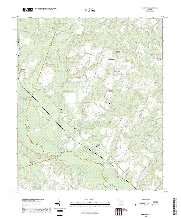
2024 Map of Rocky Ford
USGS Topo · Published 2024About this map
The Ogeechee River carves a winding path through the lowlands of Screven, Jenkins, and Bulloch Counties, defining a landscape of riparian corridors and agricultural homesteads. The small settlement of Rocky Ford serves as a local hub near the river crossing, where the surrounding terrain is dotted with family burial grounds such as the Daughtry Cem and Finch Cem. To the north, the communities of Thomasboro and Woodcliff are linked by a network of rural roads including Thomasboro Rd and Bay Branch Rd.
Find a feature on this map
68 named features on this map. Tap any name to fly to it.
Don’t see what you’re looking for? This feature index may not catch every label — zoom into the map to look around manually.
Map Details
Editions of this 2024 Rocky Ford Map
This is the sole edition of this map. No revisions or reprints were ever made.
Other maps of this area

1918 · Oliver
USGS Topo · 1:62,500

1920 · Hilltonia
USGS Topo · 1:62,500

1920 · Millen
USGS Topo · 1:62,500

1920 · Oliver
USGS Topo · 1:62,500

1921 · Rocky Ford
USGS Topo · 1:62,500

1943 · Hilltonia
USGS Topo · 1:62,500

1943 · Rocky Ford
USGS Topo · 1:62,500

1943 · Millen
USGS Topo · 1:62,500

1943 · Millen
USGS Topo · 1:125,000

1943 · Oliver
USGS Topo · 1:62,500