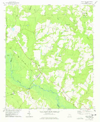
1978 Map of Rocky Ford
USGS Topo · Published 1978About this map
The Ogeechee River and its expansive wetlands form the southern boundary of this Georgia landscape, defining the character of the borderlands between Jenkins, Screven, and Bulloch Counties. The Central of Georgia railroad cuts a diagonal path through the terrain, serving as the historical spine for settlements like Rocky Ford and Scarboro. Agricultural life is evident in the numerous family-named landmarks and rural congregations, including Parker Grove Ch and Bible Fellowship Ch, which anchor the small farming communities.
Find a feature on this map
39 named features on this map. Tap any name to fly to it.
Don’t see what you’re looking for? This feature index may not catch every label — zoom into the map to look around manually.
Map Details
Editions of this 1978 Rocky Ford Map
This is the sole edition of this map. No revisions or reprints were ever made.
Other maps of this area

1918 · Oliver
USGS Topo · 1:62,500

1920 · Hilltonia
USGS Topo · 1:62,500

1920 · Millen
USGS Topo · 1:62,500

1920 · Oliver
USGS Topo · 1:62,500

1921 · Rocky Ford
USGS Topo · 1:62,500

1943 · Hilltonia
USGS Topo · 1:62,500

1943 · Rocky Ford
USGS Topo · 1:62,500

1943 · Millen
USGS Topo · 1:62,500

1943 · Millen
USGS Topo · 1:125,000

1943 · Oliver
USGS Topo · 1:62,500