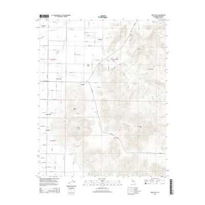
2015 Map of Rocky Hill
USGS Topo · Published 2015About this map
The agricultural transition from the San Joaquin Valley to the foothills of the Sierra Nevada dominates this 2015 study of eastern Tulare County. The Friant-Kern Canal serves as a critical man-made boundary, separating the flat valley floor from the rising elevations of the Yokohl Valley. Small communities such as Toolville, Lindcove, and Merryman are interspersed among a dense grid of rural roads, including Avenue 312 and Avenue 296. Local history is anchored by landmarks like the Hamilton Cem and named topographic features including Badger Hill and Rocky Hill. The drainage patterns of Yokohl Creek and Dry Cr illustrate the natural watershed that has shaped the development of these foothill settlements and their reliance on water management through systems like the Foothill Ditch.
Find a feature on this map
69 named features on this map. Tap any name to fly to it.
Don’t see what you’re looking for? This feature index may not catch every label — zoom into the map to look around manually.
Map Details
Editions of this 2015 Rocky Hill Map
This is the sole edition of this map. No revisions or reprints were ever made.
Other maps of this area

1904 · Kaweah
USGS Topo · 1:125,000

1909 · Kaweah
USGS Topo · 1:125,000

1925 · Rocky Hill
USGS Topo · 1:31,680

1926 · Ivanhoe
USGS Topo · 1:31,680

1926 · Exeter
USGS Topo · 1:31,680

1927 · Cairns Corner
USGS Topo · 1:31,680

1927 · Rocky Hill
USGS Topo · 1:31,680

1928 · Lemon Cove
USGS Topo · 1:31,680

1928 · Lindsay
USGS Topo · 1:31,680

1937 · Kaweah
USGS Topo · 1:125,000