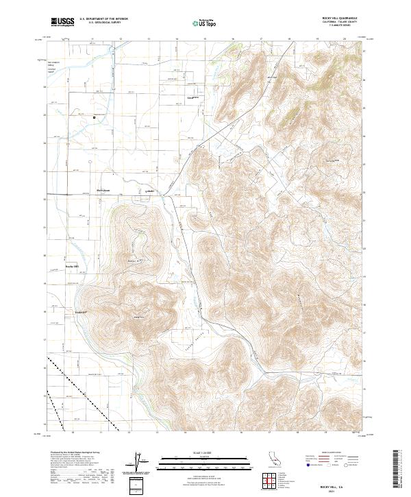
2021 Map of Rocky Hill
USGS Topo · Published 2021About this map
The San Joaquin Valley meets the rising foothills of the Sierra Nevada in this 2021 survey of the Tulare County landscape. This transition zone is defined by the vital movement of water, from the natural course of the Kaweah River in the north to the engineered path of the Friant-Kern Canal and Foothill Ditch, which support the region's agricultural productivity. Small settlements like Lindcove and Merryman anchor the valley floor, while the rugged terrain of the Yokohl Valley and Monument Hill dominates the eastern half of the sheet.
Find a feature on this map
63 named features on this map. Tap any name to fly to it.
Don’t see what you’re looking for? This feature index may not catch every label — zoom into the map to look around manually.
Map Details
Editions of this 2021 Rocky Hill Map
This is the sole edition of this map. No revisions or reprints were ever made.
Other maps of this area

1904 · Kaweah
USGS Topo · 1:125,000

1909 · Kaweah
USGS Topo · 1:125,000

1925 · Rocky Hill
USGS Topo · 1:31,680

1926 · Ivanhoe
USGS Topo · 1:31,680

1926 · Exeter
USGS Topo · 1:31,680

1927 · Cairns Corner
USGS Topo · 1:31,680

1927 · Rocky Hill
USGS Topo · 1:31,680

1928 · Lemon Cove
USGS Topo · 1:31,680

1928 · Lindsay
USGS Topo · 1:31,680

1937 · Kaweah
USGS Topo · 1:125,000