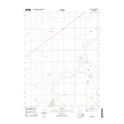
2014 Map of Rocky Knoll
USGS Topo · Published 2014About this map
The Sevier River winds through this arid section of Millard County, tracing a complex hydrological path through the Sevier Desert. The landscape is defined by the remnants of prehistoric watercourses, most notably the Old Channel Sevier River, and the presence of numerous catchments like Hardpan Reservoir and Tamarack Reservoir. To the south, the terrain descends toward the extensive basin of Sevier Lake Reservoir Number 4, while the namesake Rocky Knoll and nearby Rocky Knoll Spring provide localized relief in an otherwise low-lying alkali flat environment. Infrastructure is sparse but modern, represented by the Energy Corridor Rd and Highway 257 Rd, which cut across traditional township lines. This 2014 survey documents the area's continued reliance on managed water features, such as Clay Knoll Reservoir and Bitterweed Lake, in a region characterized by ephemeral washes and seasonal drainage patterns.
Find a feature on this map
17 named features on this map. Tap any name to fly to it.
Don’t see what you’re looking for? This feature index may not catch every label — zoom into the map to look around manually.
Map Details
Editions of this 2014 Rocky Knoll Map
This is the sole edition of this map. No revisions or reprints were ever made.
Other maps of this area

1885 · Sevier Desert
USGS Topo · 1:250,000

1908 · Fish Springs
USGS Topo · 1:250,000

1910 · Fish Springs
USGS Topo · 1:250,000

1953 · Delta
USGS Topo · 1:250,000

1958 · Delta
USGS Topo · 1:250,000

1962 · Delta
USGS Topo · 1:250,000

1971 · Red Pass
USGS Topo · 1:24,000

1971 · Clay Knoll
USGS Topo · 1:24,000

1971 · Rocky Knoll
USGS Topo · 1:24,000

1971 · Neels
USGS Topo · 1:24,000