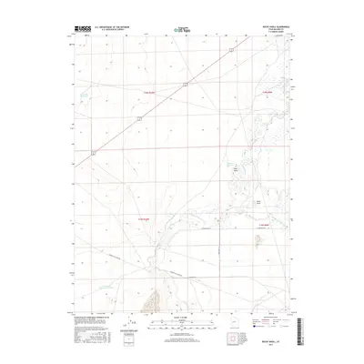
2017 Map of Rocky Knoll
USGS Topo · Published 2017About this map
The Sevier River winds through this arid expanse of Millard County, defining a landscape shaped by water management and natural drainage. This modern survey highlights the complex hydrology of the region, where the Old Channel Sevier River remains visible alongside active features like Tamarack Reservoir and Hardpan Reservoir. The terrain is punctuated by the namesake Rocky Knoll and the nearby Rocky Knoll Spring, offering a look at the essential water sources that have long dictated land use in this desert environment. Human infrastructure is represented by a sparse network of roads, including the Highway 257 Cutoff Rd, which cuts across the township and range boundaries. In the south, the presence of Sevier Lake Reservoir Number 4 further illustrates the ongoing efforts to capture and redirect runoff in this dry basin.
Find a feature on this map
16 named features on this map. Tap any name to fly to it.
Don’t see what you’re looking for? This feature index may not catch every label — zoom into the map to look around manually.
Map Details
Editions of this 2017 Rocky Knoll Map
This is the sole edition of this map. No revisions or reprints were ever made.
Other maps of this area

1885 · Sevier Desert
USGS Topo · 1:250,000

1908 · Fish Springs
USGS Topo · 1:250,000

1910 · Fish Springs
USGS Topo · 1:250,000

1953 · Delta
USGS Topo · 1:250,000

1958 · Delta
USGS Topo · 1:250,000

1962 · Delta
USGS Topo · 1:250,000

1971 · Red Pass
USGS Topo · 1:24,000

1971 · Clay Knoll
USGS Topo · 1:24,000

1971 · Rocky Knoll
USGS Topo · 1:24,000

1971 · Neels
USGS Topo · 1:24,000