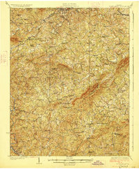
1927 Map of Rocky Mount
USGS Topo · Published 1927About this map
Thornton Mountain and Brier Mountain dominate the central landscape of this 1920s survey, illustrating a rural Virginia community defined by its complex network of ridgelines and creek valleys. The settlement pattern is anchored by the dual transport of the Norfolk and Western and Danville and Western railroads, which facilitated local trade at hubs like Lanahan Waidsboro PO. The area's agrarian roots are evident in the dense distribution of small local institutions, including Sontag School, Muddy Fork School, and Beulah Church.
Find a feature on this map
93 named features on this map. Tap any name to fly to it.
Don’t see what you’re looking for? This feature index may not catch every label — zoom into the map to look around manually.
Map Details
Editions of this 1927 Rocky Mount Map
3 editions found

Other maps of this area

1890 · Roanoke
USGS Topo · 1:125,000

1890 · Christiansburg
USGS Topo · 1:125,000

1891 · Roanoke
USGS Topo · 1:125,000

1922 · Callands
USGS Topo · 1:48,000

1924 · Martinsville
USGS Topo · 1:48,000

1924 · Draper
USGS Topo · 1:48,000

1924 · Callands
USGS Topo · 1:62,500

1925 · Rocky Mount
USGS Topo · 1:48,000

1926 · Martinsville
USGS Topo · 1:62,500

1926 · Critz
USGS Topo · 1:48,000