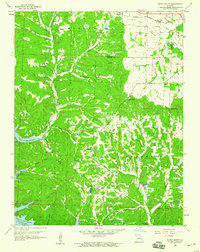
1959 Map of Rocky Mount
USGS Topo · Published 1960About this map
Lake of the Ozarks Gravois Arm defines the southern portion of this Missouri landscape, where the reservoir's waters reach deep into the winding valleys of Indian Creek and Grassy Creek. The rugged terrain of the Osage, Franklin, and Moreau townships is marked by numerous hollows, including Shelton Hollow and Louis Woods Hollow, which once supported a network of rural homesteads and institutions. The northern edge of the map features the village of Barnett along the Chicago Rock Island and Pacific railroad, reflecting the vital role of rail transport in the mid-century economy.
Find a feature on this map
48 named features on this map. Tap any name to fly to it.
Don’t see what you’re looking for? This feature index may not catch every label — zoom into the map to look around manually.
Map Details
Editions of this 1959 Rocky Mount Map
2 editions found
Other maps of this area

1888 · Versailles
USGS Topo · 1:125,000

1893 · Versailles
USGS Topo · 1:125,000

1904 · Eldon
USGS Topo · 1:62,500

1904 · Gravois Mills
USGS Topo · 1:62,500

1932 · Versailles No 4
USGS Topo · 1:48,000

1934 · Purvis
USGS Topo · 1:24,000

1934 · Lake Ozark
USGS Topo · 1:24,000

1934 · Bagnell
USGS Topo · 1:24,000

1935 · Gravois Mills
USGS Topo · 1:24,000

1935 · Rocky Mount
USGS Topo · 1:24,000