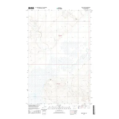
2017 Map of Rocky Point
USGS Topo · Published 2017About this map
Rocky Point and its namesake terrain feature overlook a landscape dominated by the winding path of Big Muddy Creek and the marshy expanses of Manning Lake. This corner of Roosevelt County is defined by its extensive drainage networks, where Smoke Creek and Irish Coulee carve through the high plains. The map reveals a systematic grid of rural access routes, including Slab Rd and Damm Rd, which support the agricultural and ranching operations of the Fort Kipp District. The terrain transition between the flat wetland basins and the higher elevations of Rocky Point illustrates the complex topography of the Missouri River watershed in eastern Montana. This 2017 survey serves as a precise record of water levels and land use in a region where the interplay of creek beds and coulees dictates the placement of roads and homesteads.
Find a feature on this map
20 named features on this map. Tap any name to fly to it.
Don’t see what you’re looking for? This feature index may not catch every label — zoom into the map to look around manually.
Map Details
Editions of this 2017 Rocky Point Map
This is the sole edition of this map. No revisions or reprints were ever made.
Other maps of this area

1909 · Smoke Creek
USGS Topo · 1:62,500

1912 · Smoke Creek
USGS Topo · 1:62,500

1914 · Brockton
USGS Topo · 1:62,500

1914 · Homestead
USGS Topo · 1:62,500

1947 · Rocky Point
USGS Topo · 1:24,000

1947 · Homestead
USGS Topo · 1:24,000

1948 · Homestead
USGS Topo · 1:24,000

1948 · Rocky Point
USGS Topo · 1:24,000

1948 · Fort Kipp
USGS Topo · 1:24,000

1949 · Fort Kipp
USGS Topo · 1:24,000