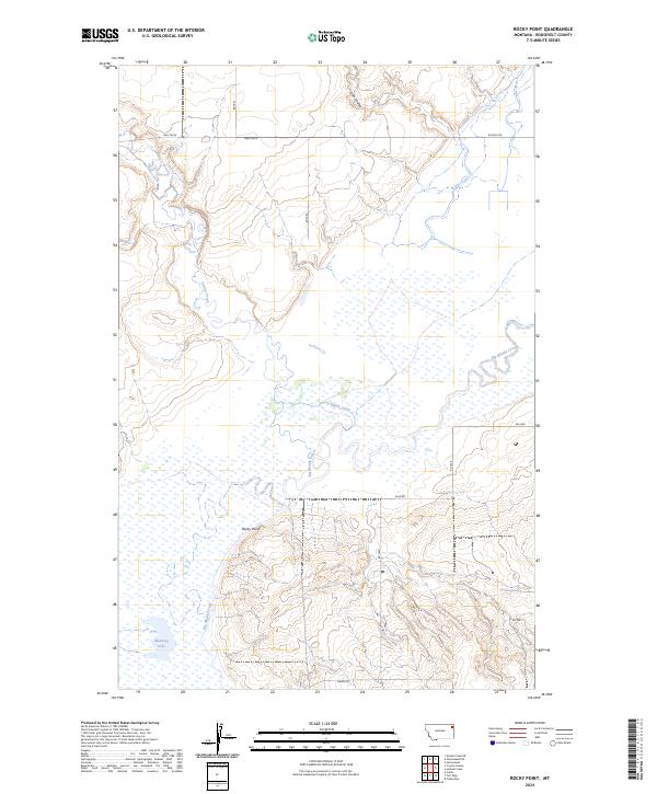
2024 Map of Rocky Point
USGS Topo · Published 2024About this map
Big Muddy Creek and Smoke Creek dominate this landscape in Roosevelt County, where the meandering waterways define the local topography. The area around Rocky Point reflects a classic Montana plains character, marked by seasonal water features like Manning Lake and the drainage of Irish Coulee. The rural infrastructure is primarily composed of a network of section-line roads, including Hwy 344 W, Hwy 344 N, and W Froid Rd, which facilitate movement across this expansive landscape. The presence of Damm Rd and Slab Rd suggests the practical, utilitarian development typical of modern agricultural and resource management in the region, while the creek systems continue to shape the drainage patterns of the Missouri River basin hinterlands.
Find a feature on this map
20 named features on this map. Tap any name to fly to it.
Don’t see what you’re looking for? This feature index may not catch every label — zoom into the map to look around manually.
Map Details
Editions of this 2024 Rocky Point Map
This is the sole edition of this map. No revisions or reprints were ever made.
Other maps of this area

1909 · Smoke Creek
USGS Topo · 1:62,500

1912 · Smoke Creek
USGS Topo · 1:62,500

1914 · Brockton
USGS Topo · 1:62,500

1914 · Homestead
USGS Topo · 1:62,500

1947 · Rocky Point
USGS Topo · 1:24,000

1947 · Homestead
USGS Topo · 1:24,000

1948 · Homestead
USGS Topo · 1:24,000

1948 · Rocky Point
USGS Topo · 1:24,000

1948 · Fort Kipp
USGS Topo · 1:24,000

1949 · Fort Kipp
USGS Topo · 1:24,000