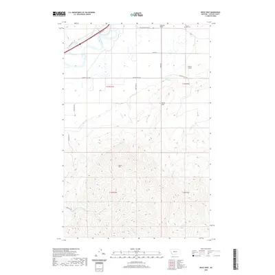
2020 Map of Rocky Reef
USGS Topo · Published 2020About this map
Chestnut Valley dominates this section of Cascade County, where the plains meet the dramatic rise of the northern Big Belt foothills. The Missouri River cuts through the northwest corner, shadowed by Old US Hwy 91 and the riparian wetlands of Vintinger Slough. Human engineering is evident in the Chestnut Valley Canal, which skirts the base of the higher elevations to manage water across the lower ranchlands.
Find a feature on this map
30 named features on this map. Tap any name to fly to it.
Don’t see what you’re looking for? This feature index may not catch every label — zoom into the map to look around manually.
Map Details
Editions of this 2020 Rocky Reef Map
This is the sole edition of this map. No revisions or reprints were ever made.
Other maps of this area

1886 · Great Falls
USGS Topo · 1:250,000

1949 · Cascade
USGS Topo · 1:62,500

1951 · Cascade
USGS Topo · 1:62,500

1954 · Great Falls
USGS Topo · 1:250,000

1957 · Great Falls
USGS Topo · 1:250,000

1960 · Simms
USGS Topo · 1:62,500

1961 · Hardy
USGS Topo · 1:24,000

1961 · Hound Creek Reservoir
USGS Topo · 1:24,000

1961 · Rocky Reef
USGS Topo · 1:24,000

1961 · Schrammeck Lake
USGS Topo · 1:24,000