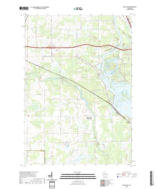
2022 Map of Rocky Run
USGS Topo · Published 2022About this map
Mill Creek Community sits near the heart of this central Wisconsin landscape, where the waters of Mill Creek wind toward the expansive Wisconsin River Flowage. The map captures the complex hydrology of the region, defined by extensive wetlands like Fogarty Marsh and Bear Creek Marsh. These natural features are bounded by the prominent Wisconsin Ridge, which influences the local topography and road network. Along the eastern edge, the Wisconsin River creates a jagged shoreline of inlets and points near Rocky Run. The transition from the rural roads of the interior, such as Town Line Rd and Ridge Rd, to the lakeside developments like Martin Island Dr illustrates the dual nature of this area as both a traditional agricultural community and a site for riverfront recreation.
Find a feature on this map
37 named features on this map. Tap any name to fly to it.
Don’t see what you’re looking for? This feature index may not catch every label — zoom into the map to look around manually.
Map Details
Editions of this 2022 Rocky Run Map
This is the sole edition of this map. No revisions or reprints were ever made.
Other maps of this area

1955 · Green Bay
USGS Topo · 1:250,000

1956 · Milladore
USGS Topo · 1:48,000

1956 · Stevens Point
USGS Topo · 1:48,000

1957 · Wisconsin Rapids
USGS Topo · 1:48,000

1957 · Whiting
USGS Topo · 1:48,000

1967 · Wisconsin Rapids
USGS Topo · 1:62,500

1970 · Junction City
USGS Topo · 1:24,000

1970 · Stevens Point
USGS Topo · 1:24,000
1970 · Rocky Run
USGS Topo · 1:24,000
1970 · Meehan
USGS Topo · 1:24,000