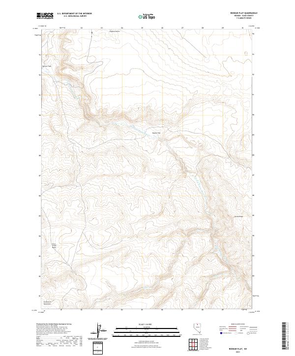
2021 Map of Rodear Flat
USGS Topo · Published 2021About this map
Rodear Flat lies at the heart of this high-desert landscape in Elko County, where the S Fork Little Humboldt River carves a winding path through the arid terrain. The northern reaches are dominated by the vast Owyhee Desert, while the southern portion of the sheet rises into the Snowstorm Mountains. This 2021 survey documents a sparsely populated region characterized by distinct geographic landmarks and ranching features like Button Field. The drainage patterns are clearly defined by Snowstorm Cr and First Cr, which feed into the primary river system. Local relief is provided by prominent formations such as Castle Ridge and the First Creek Basin, illustrating the complex topography that defines this remote corner of Nevada.
Find a feature on this map
15 named features on this map. Tap any name to fly to it.
Don’t see what you’re looking for? This feature index may not catch every label — zoom into the map to look around manually.
Map Details
Editions of this 2021 Rodear Flat Map
This is the sole edition of this map. No revisions or reprints were ever made.
Other maps of this area

1882 · Paradise
USGS Topo · 1:250,000

1893 · Paradise
USGS Topo · 1:250,000

1955 · McDermitt
USGS Topo · 1:250,000

1959 · McDermitt
USGS Topo · 1:250,000

1973 · Snowstorm Mtn
USGS Topo · 1:24,000
1973 · Rodear Flat
USGS Topo · 1:24,000

1973 · McCleary Wells
USGS Topo · 1:24,000

1973 · Haystack Peak
USGS Topo · 1:24,000

1973 · Humboldt Hill
USGS Topo · 1:24,000
1977 · Oregon Canyon
USGS Topo · 1:24,000