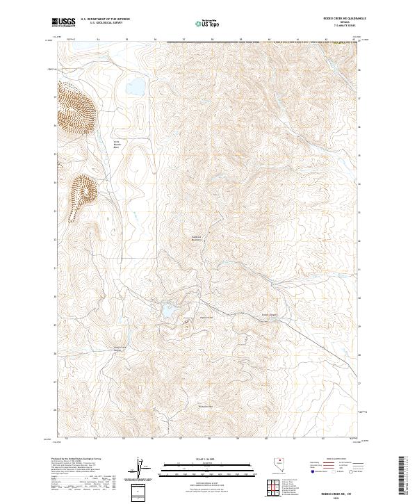
2021 Map of Rodeo Creek NE
USGS Topo · Published 2021About this map
Tuscarora Mountains dominate the central relief of this quadrangle, forming a divide between several high-altitude drainages. To the west, the landscape opens into Little Boulder Basin, while the eastern portion is characterized by a complex network of canyons and named peaks. Notable elevations include Richmond Mtn and Popovich Hill, which rise above the surrounding drainages of Indian Cr and Simon Cr. The hydrology is defined by a dendritic pattern of mountain streams, including Rodeo Cr and Cottonwood Cr, which have carved distinctive landforms like Simons Canyon and Sheep Creek Canyon. This high-desert terrain in northern Eureka Co reflects a landscape managed by federal agencies, with section lines and township boundaries like t36n r50e overlaying a topography defined by steep ridges and narrow creek beds.
Find a feature on this map
20 named features on this map. Tap any name to fly to it.
Don’t see what you’re looking for? This feature index may not catch every label — zoom into the map to look around manually.
Map Details
Editions of this 2021 Rodeo Creek NE Map
This is the sole edition of this map. No revisions or reprints were ever made.
Other maps of this area

1955 · McDermitt
USGS Topo · 1:250,000

1955 · Winnemucca
USGS Topo · 1:250,000

1958 · Winnemucca
USGS Topo · 1:250,000

1959 · McDermitt
USGS Topo · 1:250,000

1962 · Winnemucca
USGS Topo · 1:250,000

1968 · Rodeo Creek SW
USGS Topo · 1:24,000

1968 · Rodeo Creek NE
USGS Topo · 1:24,000

1968 · Welches Canyon
USGS Topo · 1:24,000

1968 · Swales Mountain NW
USGS Topo · 1:24,000

1968 · Rodeo Creek NW
USGS Topo · 1:24,000