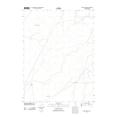
2012 Map of Rodeo Creek NW
USGS Topo · Published 2012About this map
The Sheep Creek Range dominates the northern landscape of this Eureka County region, giving way to the broad expanses of the Boulder Valley in the south. This 2012 survey documents a sparsely settled high-desert environment where water management is central to the land's utility. Significant drainage systems, including the namesake Rodeo Creek, Boulder Creek, and Bell Creek, carve through the terrain, suggesting a landscape defined by seasonal flows and cattle ranching infrastructure. Isolated landmarks like the Boulder Windmill and Sheep Creek Windmill serve as critical navigational and functional points for those working the land. The network of local roads and 4WD tracks weaving between these water sources reflects the ongoing importance of range management and resource access in this part of Nevada.
Find a feature on this map
8 named features on this map. Tap any name to fly to it.
Don’t see what you’re looking for? This feature index may not catch every label — zoom into the map to look around manually.
Map Details
Editions of this 2012 Rodeo Creek NW Map
This is the sole edition of this map. No revisions or reprints were ever made.
Other maps of this area

1955 · McDermitt
USGS Topo · 1:250,000

1955 · Winnemucca
USGS Topo · 1:250,000

1958 · Winnemucca
USGS Topo · 1:250,000

1959 · McDermitt
USGS Topo · 1:250,000

1962 · Winnemucca
USGS Topo · 1:250,000

1965 · Sheep Creek Range NE
USGS Topo · 1:24,000

1965 · Sheep Creek Range SE
USGS Topo · 1:24,000
1965 · Willow Creek Reservoir SE
USGS Topo · 1:24,000

1968 · Rodeo Creek SW
USGS Topo · 1:24,000

1968 · Rodeo Creek NE
USGS Topo · 1:24,000