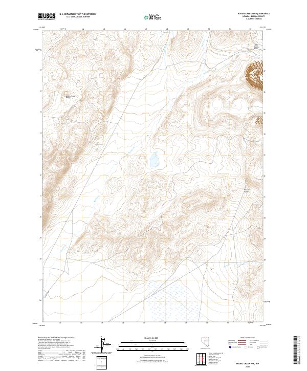
2021 Map of Rodeo Creek NW
USGS Topo · Published 2021About this map
The Sheep Creek Range dominates the western portion of this 2021 topographic study, characterized by high-elevation terrain that descends into the broad expanse of Boulder Valley. This landscape in Eureka County is defined by its drainage systems, where Boulder Cr and its tributaries carve paths through the mountain slopes. To the northeast, the terrain opens into Little Boulder Basin, a distinct geological feature near the boundary of T36N R50E. The mapping detail shows a network of seasonal watercourses, including Bell Cr, Rodeo Cr, and Sheep Cr, which illustrate the hydrological patterns of this high-desert environment. The absence of developed settlements highlights the area's use for grazing and resource management within the Public Land Survey System.
Find a feature on this map
12 named features on this map. Tap any name to fly to it.
Don’t see what you’re looking for? This feature index may not catch every label — zoom into the map to look around manually.
Map Details
Editions of this 2021 Rodeo Creek NW Map
This is the sole edition of this map. No revisions or reprints were ever made.
Other maps of this area

1955 · McDermitt
USGS Topo · 1:250,000

1955 · Winnemucca
USGS Topo · 1:250,000

1958 · Winnemucca
USGS Topo · 1:250,000

1959 · McDermitt
USGS Topo · 1:250,000

1962 · Winnemucca
USGS Topo · 1:250,000

1965 · Sheep Creek Range NE
USGS Topo · 1:24,000

1965 · Sheep Creek Range SE
USGS Topo · 1:24,000
1965 · Willow Creek Reservoir SE
USGS Topo · 1:24,000

1968 · Rodeo Creek SW
USGS Topo · 1:24,000

1968 · Rodeo Creek NE
USGS Topo · 1:24,000