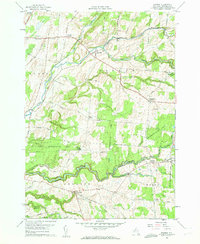
1959 Map of Rodman
USGS Topo · Published 1961About this map
Sandy Creek carves a deep path through this Jefferson County landscape, where the agricultural plateaus are interrupted by dramatic ravines like Inman Gulf and Lorraine Gulf. During the late 1950s, the area's rural character was defined by a network of crossroad settlements including Rodman, Lorraine, and Worth. These communities served as local hubs connected by routes such as the Old Rome Road and Dry Hill Road.
Find a feature on this map
77 named features on this map. Tap any name to fly to it.
Don’t see what you’re looking for? This feature index may not catch every label — zoom into the map to look around manually.
Map Details
Editions of this 1959 Rodman Map
3 editions found
Other maps of this area

1893 · Sackets Harbor
USGS Topo · 1:62,500

1895 · Sacketts Harbor
USGS Topo · 1:62,500

1895 · Pulaski
USGS Topo · 1:62,500

1895 · Watertown
USGS Topo · 1:62,500

1898 · Watertown
USGS Topo · 1:62,500

1903 · Orwell
USGS Topo · 1:62,500

1905 · Orwell
USGS Topo · 1:62,500

1908 · Watertown
USGS Topo · 1:62,500

1909 · Watertown
USGS Topo · 1:62,500

1942 · Sandy Creek
USGS Topo · 1:24,000