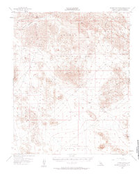
1955 Map of Rodman Mountains
USGS Topo · Published 1961About this map
Rodman Mountains and the Newberry Mountains dominate this mid-century desert landscape, where mineral extraction and military training shaped the land use. The map reveals a high concentration of mining activity throughout the arid ranges, including the Camp Rock Mine, Silver Bell Mine, and Copper Strand Mine. These operations are connected by a primitive network of jeep trails and the historic Kane Springs Trail, which navigates through the volcanic Lava flows and the Kane Wash.
Find a feature on this map
25 named features on this map. Tap any name to fly to it.
Don’t see what you’re looking for? This feature index may not catch every label — zoom into the map to look around manually.
Map Details
Editions of this 1955 Rodman Mountains Map
3 editions found

Other maps of this area

1901 · Southern California Sheet No. 1
USGS Topo · 1:250,000

1902 · San Gorgonio
USGS Topo · 1:125,000

1904 · Southern California Sheet No. 1
USGS Topo · 1:250,000

1947 · Lucerne Valley
USGS Topo · 1:62,500

1949 · Lucerne Valley
USGS Topo · 1:62,500

1953 · San Bernardino
USGS Topo · 1:250,000

1954 · Galway Lake
USGS Topo · 1:24,000

1954 · Emerson Lake
USGS Topo · 1:24,000

1955 · Silver Bell Mine
USGS Topo · 1:24,000

1955 · Sunshine Peak
USGS Topo · 1:24,000