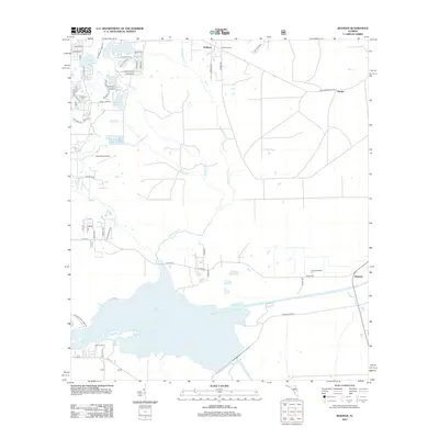
2012 Map of Rodman
USGS Topo · Published 2012About this map
Lake Ocklawaha dominates the southern landscape of this Putnam County region, created by the damming of the Ocklawaha River. The surrounding area is a network of smaller water bodies and seasonal drainages, including Blue Springs and Sweetwater Cr, which feed into the primary river system. Local transit and community life are centered around the settlements of Hollister, Rodman, and Hunter, with the Oak Ridge Airport serving as a localized aviation landmark. The presence of Cedar Landing and various named points like Rainbow Ranch suggests a rural Florida economy tied closely to the water and surrounding timberlands. Notable landmarks such as the Hollister Tower provide vertical reference points in an otherwise low-lying terrain characterized by numerous lakes like Hasenjaeger Lake and Hardesty Lake. This map captures the modern hydrological state of the Ocklawaha basin as it appeared in the early 21st century.
Find a feature on this map
64 named features on this map. Tap any name to fly to it.
Don’t see what you’re looking for? This feature index may not catch every label — zoom into the map to look around manually.
Map Details
Editions of this 2012 Rodman Map
This is the sole edition of this map. No revisions or reprints were ever made.
Other maps of this area

1912 · Palatka
USGS Topo · 1:48,000

1915 · Palatka
USGS Topo · 1:62,500

1915 · Interlachen
USGS Topo · 1:48,000

1916 · Interlachen
USGS Topo · 1:62,500

1944 · Interlachen
USGS Topo · 1:62,500

1949 · Keuka
USGS Topo · 1:24,000

1949 · Baywood
USGS Topo · 1:24,000

1949 · Rodman
USGS Topo · 1:24,000
1949 · Putnam Hall
USGS Topo · 1:24,000

1949 · Interlachen
USGS Topo · 1:62,500