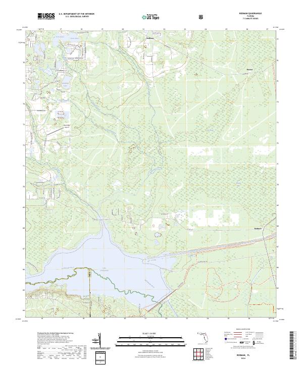
2024 Map of Rodman
USGS Topo · Published 2024About this map
Rodman and Hollister anchor a landscape defined by the engineered and natural waterways of Putnam County. The northern reaches of the Ocala National Forest meet the southern edge of the map at the Ocklawaha River, which broadens into Lake Ocklawaha. This region is a critical intersection of Florida's hydrology and land management history, featuring the Cross Florida Barge Canal and the Caravelle Ranch Wildlife Management Area. The terrain transitions from the well-defined basins of Twin Lakes and Hardesty Lake in the north to the low-lying wetlands of The Slash and Cow Heaven Bay further east. Evidence of rural infrastructure is seen at the Oak Ridge Airport and a network of named tracks like Possum Walk Rd and Turkey Run Rd that navigate the drainages of Alligator Creek and Sweetwater Creek.
Find a feature on this map
71 named features on this map. Tap any name to fly to it.
Don’t see what you’re looking for? This feature index may not catch every label — zoom into the map to look around manually.
Map Details
Editions of this 2024 Rodman Map
This is the sole edition of this map. No revisions or reprints were ever made.
Other maps of this area

1912 · Palatka
USGS Topo · 1:48,000

1915 · Palatka
USGS Topo · 1:62,500

1915 · Interlachen
USGS Topo · 1:48,000

1916 · Interlachen
USGS Topo · 1:62,500

1944 · Interlachen
USGS Topo · 1:62,500

1949 · Keuka
USGS Topo · 1:24,000

1949 · Baywood
USGS Topo · 1:24,000

1949 · Rodman
USGS Topo · 1:24,000
1949 · Putnam Hall
USGS Topo · 1:24,000

1949 · Interlachen
USGS Topo · 1:62,500