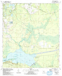
1993 Map of Rodman
USGS Topo · Published 1993About this map
Ocklawaha Lake and the Ocklawaha River dominate this Central Florida landscape, reflecting the complex water management history of the region. The map documents the engineering of the Cross Florida Barge Canal and the presence of the Rodman Dam, which transformed the local hydrology. North of the river, the terrain is marked by numerous smaller water bodies such as Twin Lakes and Hardesty Lake, and large marshy areas like Cow Heaven Bay and The Slash.
Find a feature on this map
44 named features on this map. Tap any name to fly to it.
Don’t see what you’re looking for? This feature index may not catch every label — zoom into the map to look around manually.
Map Details
Editions of this 1993 Rodman Map
This is the sole edition of this map. No revisions or reprints were ever made.
Other maps of this area

1912 · Palatka
USGS Topo · 1:48,000

1915 · Palatka
USGS Topo · 1:62,500

1915 · Interlachen
USGS Topo · 1:48,000

1916 · Interlachen
USGS Topo · 1:62,500

1944 · Interlachen
USGS Topo · 1:62,500

1949 · Keuka
USGS Topo · 1:24,000

1949 · Baywood
USGS Topo · 1:24,000

1949 · Rodman
USGS Topo · 1:24,000
1949 · Putnam Hall
USGS Topo · 1:24,000

1949 · Interlachen
USGS Topo · 1:62,500