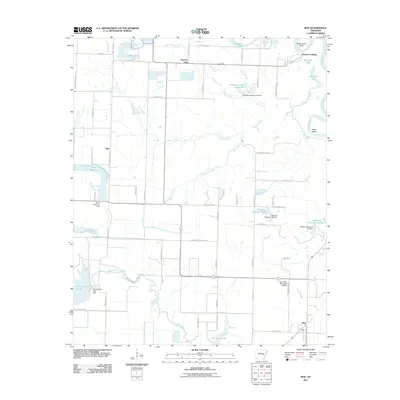
2011 Map of Roe
USGS Topo · Published 2011About this map
Roe sits at the southern edge of this Monroe County landscape, where the agricultural plains meet the intricate wetlands of the White River valley. The eastern border is defined by the winding course of the White River, which creates distinctive landforms like Hilderbrand Bend and Wolf Bend. This area is heavily managed for water, evidenced by a network of engineered features including Peckerwood Lake, Stroh Reservoir, and Newkirks Reservoir Number 1. These bodies of water, many held by structures such as the Peckerwood Lake Dam, suggest a landscape deeply tied to irrigation and drainage.
Find a feature on this map
68 named features on this map. Tap any name to fly to it.
Don’t see what you’re looking for? This feature index may not catch every label — zoom into the map to look around manually.
Map Details
Editions of this 2011 Roe Map
This is the sole edition of this map. No revisions or reprints were ever made.
Other maps of this area

1935 · Hazen
USGS Topo · 1:62,500

1935 · Clarendon
USGS Topo · 1:62,500

1937 · Stuttgart
USGS Topo · 1:62,500

1939 · Stuttgart
USGS Topo · 1:62,500

1941 · Hazen
USGS Topo · 1:62,500

1941 · De Valls Bluff
USGS Topo · 1:62,500

1941 · Clarendon
USGS Topo · 1:62,500

1948 · Helena
USGS Topo · 1:250,000

1950 · Helena
USGS Topo · 1:250,000

1955 · Helena
USGS Topo · 1:250,000