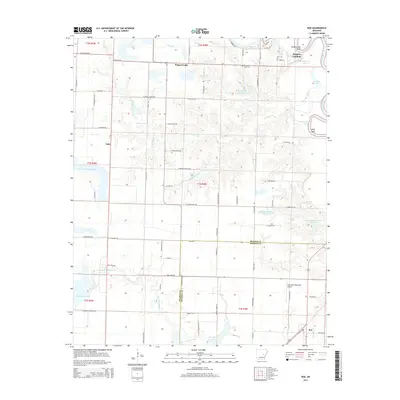
2014 Map of Roe
USGS Topo · Published 2014About this map
The White River and its intricate network of bayous and sloughs define this section of the Arkansas Delta, where the landscape is marked by a legacy of water management and agricultural drainage. Along the eastern edge, the river creates distinct landmarks like Hilderbrand Bend and Wolf Bend, while the interior is dotted with significant man-made water features including Wing Meade Reservoir and the Newkirks Reservoir Number 1. Small settlements such as Roe and Vaby are linked by a grid of rural roads, many bearing family names that speak to the region's genealogical history.
Find a feature on this map
86 named features on this map. Tap any name to fly to it.
Don’t see what you’re looking for? This feature index may not catch every label — zoom into the map to look around manually.
Map Details
Editions of this 2014 Roe Map
This is the sole edition of this map. No revisions or reprints were ever made.
Other maps of this area

1935 · Hazen
USGS Topo · 1:62,500

1935 · Clarendon
USGS Topo · 1:62,500

1937 · Stuttgart
USGS Topo · 1:62,500

1939 · Stuttgart
USGS Topo · 1:62,500

1941 · Hazen
USGS Topo · 1:62,500

1941 · De Valls Bluff
USGS Topo · 1:62,500

1941 · Clarendon
USGS Topo · 1:62,500

1948 · Helena
USGS Topo · 1:250,000

1950 · Helena
USGS Topo · 1:250,000

1955 · Helena
USGS Topo · 1:250,000