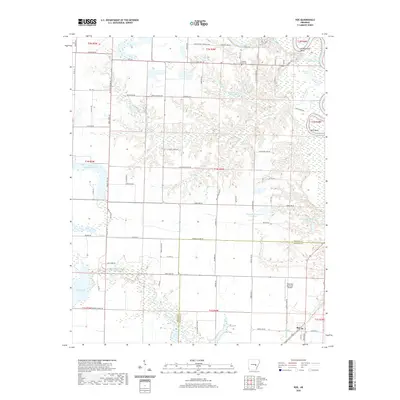
2020 Map of Roe
USGS Topo · Published 2020About this map
Roe sits at the center of a complex network of waterways and agricultural land in Monroe County, defining a landscape shaped by the White River and its numerous oxbows. The terrain is characterized by intricate drainage systems, including La Grue Bayou and Roc Roe Bayou, which weave through the lowlands alongside larger bodies of water like Peckerwood Lake. These water features, paired with managed sites such as Newkirks Reservoir Number 1, illustrate the region's long-standing relationship with water management for farming. Genealogists and local historians can locate the Pleasant Home Cem and the river-bend landmark of Peppers Eddy in the northern portion of the quadrangle. The presence of the Clarendon Municipal Airport and a grid of rural roads like Co Rd 214 and Monroe Co Line Rd highlight the area's continued role as a connected rural hub between the bayous and the river.
Find a feature on this map
95 named features on this map. Tap any name to fly to it.
Don’t see what you’re looking for? This feature index may not catch every label — zoom into the map to look around manually.
Map Details
Editions of this 2020 Roe Map
This is the sole edition of this map. No revisions or reprints were ever made.
Other maps of this area

1935 · Hazen
USGS Topo · 1:62,500

1935 · Clarendon
USGS Topo · 1:62,500

1937 · Stuttgart
USGS Topo · 1:62,500

1939 · Stuttgart
USGS Topo · 1:62,500

1941 · Hazen
USGS Topo · 1:62,500

1941 · De Valls Bluff
USGS Topo · 1:62,500

1941 · Clarendon
USGS Topo · 1:62,500

1948 · Helena
USGS Topo · 1:250,000

1950 · Helena
USGS Topo · 1:250,000

1955 · Helena
USGS Topo · 1:250,000