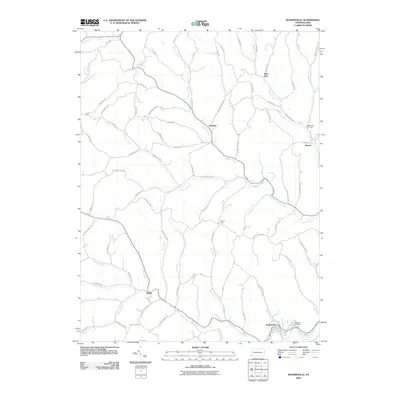
2010 Map of Rogersville
USGS Topo · Published 2010About this map
Nineveh sits at a junction of valley roads and the meandering Browns Creek, serving as a central point in this rural landscape of southwestern Pennsylvania. The area's topography is defined by prominent ridges such as Beulah Ridge and Hopewell Ridge, which separate the various runs and forks of the South Fork Tenmile Creek watershed. This 2010 survey illustrates the persistence of small crossroad settlements like Deer Lick, Rutan, and Swarts, many of which developed around early post offices and local trade.
Find a feature on this map
80 named features on this map. Tap any name to fly to it.
Don’t see what you’re looking for? This feature index may not catch every label — zoom into the map to look around manually.
Map Details
Editions of this 2010 Rogersville Map
This is the sole edition of this map. No revisions or reprints were ever made.
Other maps of this area

1901 · Amity
USGS Topo · 1:62,500

1901 · Waynesburg
USGS Topo · 1:62,500

1904 · Amity
USGS Topo · 1:62,500

1904 · Waynesburg
USGS Topo · 1:62,500

1905 · Rogersville
USGS Topo · 1:62,500

1907 · Claysville
USGS Topo · 1:62,500

1949 · Clarksburg
USGS Topo · 1:250,000

1951 · Canton
USGS Topo · 1:250,000

1953 · Canton
USGS Topo · 1:250,000
1954 · Amity
USGS Topo · 1:24,000