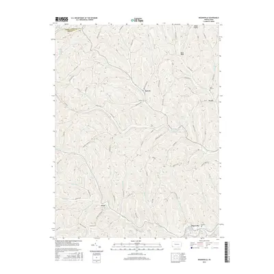
2016 Map of Rogersville
USGS Topo · Published 2016About this map
Rogersville and the winding course of South Fork Tenmile Cr anchor the southeastern corner of this Pennsylvania landscape. The terrain is defined by a dense network of ridges and hollows, where narrow valley floors support small communities like Nineveh, Rutan, and Swarts. Local history is preserved in sites such as Rosemont Cem and Bates Fork Cem, which sit alongside early transit routes.
Find a feature on this map
70 named features on this map. Tap any name to fly to it.
Don’t see what you’re looking for? This feature index may not catch every label — zoom into the map to look around manually.
Map Details
Editions of this 2016 Rogersville Map
This is the sole edition of this map. No revisions or reprints were ever made.
Other maps of this area

1901 · Amity
USGS Topo · 1:62,500

1901 · Waynesburg
USGS Topo · 1:62,500

1904 · Amity
USGS Topo · 1:62,500

1904 · Waynesburg
USGS Topo · 1:62,500

1905 · Rogersville
USGS Topo · 1:62,500

1907 · Claysville
USGS Topo · 1:62,500

1949 · Clarksburg
USGS Topo · 1:250,000

1951 · Canton
USGS Topo · 1:250,000

1953 · Canton
USGS Topo · 1:250,000
1954 · Amity
USGS Topo · 1:24,000