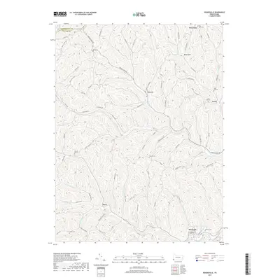
2019 Map of Rogersville
USGS Topo · Published 2019About this map
Washington Co and Greene Co meet along a ridgeline in this southwestern Pennsylvania landscape, where the terrain is defined by the winding drainages of the South Fork Tenmile Creek and Enlow Fork. The area is dotted with small rural settlements like Nineveh, Rogersville, and Rutan, each connected by a complex network of ridge-and-valley roads such as Browns Creek RD and Hopewell Ridge RD. This map reveals a high density of ancestral sites for local historians, featuring numerous small burial grounds including South Ten Mile Cem, Claylick Cem, and Green Grove Cem. The presence of the W B & W Railroad RD near Deer Lick indicates the historic importance of rail transport for moving goods and people through these deep valleys. Notable landmarks like Devils Half-Acre and Beulah Ridge further characterize the upland topography that separates the many runs and creeks flowing toward the Monongahela watershed.
Find a feature on this map
77 named features on this map. Tap any name to fly to it.
Don’t see what you’re looking for? This feature index may not catch every label — zoom into the map to look around manually.
Map Details
Editions of this 2019 Rogersville Map
This is the sole edition of this map. No revisions or reprints were ever made.
Other maps of this area

1901 · Amity
USGS Topo · 1:62,500

1901 · Waynesburg
USGS Topo · 1:62,500

1904 · Amity
USGS Topo · 1:62,500

1904 · Waynesburg
USGS Topo · 1:62,500

1905 · Rogersville
USGS Topo · 1:62,500

1907 · Claysville
USGS Topo · 1:62,500

1949 · Clarksburg
USGS Topo · 1:250,000

1951 · Canton
USGS Topo · 1:250,000

1953 · Canton
USGS Topo · 1:250,000
1954 · Amity
USGS Topo · 1:24,000