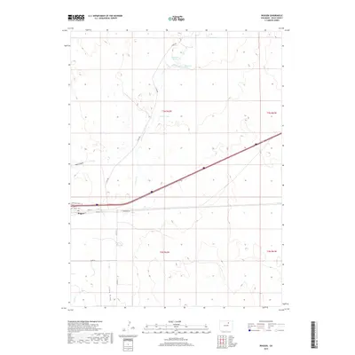
2019 Map of Roggen
USGS Topo · Published 2019About this map
Roggen serves as the primary hub of this high plains landscape in Weld County, situated along a vital transportation corridor defined by Frontage Road I-76 and the modern interstate. The settlement is anchored by local infrastructure including the Po and a grid of streets such as Front St and 2nd St. The surrounding terrain is heavily influenced by water management and intermittent drainage systems, characterized by the branching paths of Lost Cr and E Lost Cr. Several significant water bodies dot the agricultural expanse, including Monahan Lakes and Lost Cr Reservoir Number 1 to the north, alongside Waite Lake and French Lake. These reservoirs and the presence of Long Draw suggest a landscape deeply tied to water storage and diversion for prairie agriculture.
Find a feature on this map
23 named features on this map. Tap any name to fly to it.
Don’t see what you’re looking for? This feature index may not catch every label — zoom into the map to look around manually.
Map Details
Editions of this 2019 Roggen Map
This is the sole edition of this map. No revisions or reprints were ever made.
Other maps of this area

1950 · South Roggen
USGS Topo · 1:24,000

1950 · Wiggins SW
USGS Topo · 1:24,000

1950 · Tampa
USGS Topo · 1:24,000

1950 · Prospect Valley
USGS Topo · 1:24,000

1950 · Masters
USGS Topo · 1:24,000

1950 · Hardin
USGS Topo · 1:24,000

1951 · Prospect Valley
USGS Topo · 1:24,000

1951 · Masters
USGS Topo · 1:24,000

1951 · Hardin
USGS Topo · 1:24,000

1951 · Roggen
USGS Topo · 1:24,000