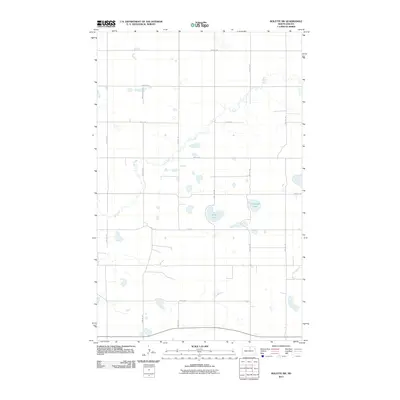
2011 Map of Rolette SW
USGS Topo · Published 2011About this map
Ox Creek meanders across this rural Rolette County landscape, defining the hydrology of a region characterized by scattered glacial prairie potholes. The terrain is dominated by a systematic grid of section roads, including north-south corridors like 35th Ave NE and 32nd Ave NE, which provide access to the agricultural tracts between water bodies. Two prominent permanent features, Wright Lake and Kishpaugh Lake, sit east of the central meridian, serving as local landmarks in an otherwise open, prairie environment. This 2011 survey illustrates the modern persistence of the Public Land Survey System, where road placement strictly follows the township and range lines established over a century prior.
Find a feature on this map
16 named features on this map. Tap any name to fly to it.
Don’t see what you’re looking for? This feature index may not catch every label — zoom into the map to look around manually.
Map Details
Editions of this 2011 Rolette SW Map
This is the sole edition of this map. No revisions or reprints were ever made.
Other maps of this area

1953 · Devils Lake
USGS Topo · 1:250,000

1954 · Overly SE
USGS Topo · 1:24,000

1954 · Rugby NW
USGS Topo · 1:24,000

1954 · Leverich
USGS Topo · 1:24,000

1954 · Minot
USGS Topo · 1:250,000

1955 · Fonda
USGS Topo · 1:24,000

1955 · Thorne
USGS Topo · 1:24,000

1955 · Rolette SW
USGS Topo · 1:24,000

1956 · Devils Lake
USGS Topo · 1:250,000

1958 · Minot
USGS Topo · 1:250,000