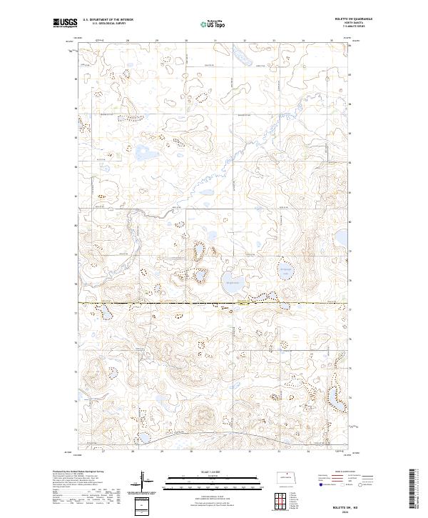
2024 Map of Rolette SW
USGS Topo · Published 2024About this map
The glacial prairie landscape of the Rolette Co Pierce Co border is defined by a complex network of wetlands and conservation lands. At the center of this 2024 survey, the Rolette County Waterfowl Production Area and the Pierce County Waterfowl Production Area preserve vital habitat across the township lines of t159n r72w and t158n r72w. Water bodies such as Wright Lake and Kishpaugh Lake are prominent features within these protected zones, while the seasonal flow of Ox Creek meanders through the northern sections. A rigid grid of section roads, including Willow City Rd and Rolette Rd, provides access through this agricultural and conservation-focused terrain, reflecting the enduring Public Land Survey System structure that has organized this portion of North Dakota since settlement.
Find a feature on this map
20 named features on this map. Tap any name to fly to it.
Don’t see what you’re looking for? This feature index may not catch every label — zoom into the map to look around manually.
Map Details
Editions of this 2024 Rolette SW Map
This is the sole edition of this map. No revisions or reprints were ever made.
Other maps of this area

1953 · Devils Lake
USGS Topo · 1:250,000

1954 · Overly SE
USGS Topo · 1:24,000

1954 · Rugby NW
USGS Topo · 1:24,000

1954 · Leverich
USGS Topo · 1:24,000

1954 · Minot
USGS Topo · 1:250,000

1955 · Fonda
USGS Topo · 1:24,000

1955 · Thorne
USGS Topo · 1:24,000

1955 · Rolette SW
USGS Topo · 1:24,000

1956 · Devils Lake
USGS Topo · 1:250,000

1958 · Minot
USGS Topo · 1:250,000