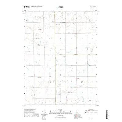
2019 Map of Roll
USGS Topo · Published 2019About this map
Farrville and the neighboring rural communities of Dillman and Jadden occupy a landscape defined by an extensive network of drainage infrastructure in the early 21st century. This region, where Grant, Wells, and Blackford Counties meet, is crisscrossed by an intricate system of man-made waterways like the Sweetser Improvement Ditch and Enoch Lee Ditch, which support the intensive agricultural use of the land. The presence of numerous family and community burial grounds, such as Doyle Cem and Balsley Cem, highlights the long-established settlement patterns and genealogical depth of these townships.
Find a feature on this map
68 named features on this map. Tap any name to fly to it.
Don’t see what you’re looking for? This feature index may not catch every label — zoom into the map to look around manually.
Map Details
Editions of this 2019 Roll Map
This is the sole edition of this map. No revisions or reprints were ever made.
Other maps of this area

1950 · Warren
USGS Topo · 1:24,000

1950 · Mount Etna
USGS Topo · 1:24,000

1951 · Mount Etna
USGS Topo · 1:24,000

1952 · Warren
USGS Topo · 1:24,000

1953 · Muncie
USGS Topo · 1:250,000

1956 · Muncie
USGS Topo · 1:250,000

1960 · Hartford City East
USGS Topo · 1:24,000

1960 · Gas City
USGS Topo · 1:24,000

1960 · Hartford City West
USGS Topo · 1:24,000

1962 · Montpelier
USGS Topo · 1:24,000