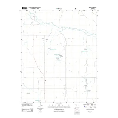
2011 Map of Roll
USGS Topo · Published 2011About this map
Roll serves as the central community of this western Oklahoma landscape, situated at the intersection of several section-line roads. The terrain is defined by the broad path of the Canadian River as it winds through the northern portion of the quadrangle, crossed by the notable Pack Saddle Bridge. To the south, the landscape transitions into several distinct plains and water systems, including the flat expanse of Pie Flat and the surrounding drainage of Wagon Creek and Bois dArc Creek.
Find a feature on this map
30 named features on this map. Tap any name to fly to it.
Don’t see what you’re looking for? This feature index may not catch every label — zoom into the map to look around manually.
Map Details
Editions of this 2011 Roll Map
This is the sole edition of this map. No revisions or reprints were ever made.
Other maps of this area

1955 · Clinton
USGS Topo · 1:250,000

1957 · Clinton
USGS Topo · 1:250,000

1960 · Cheyenne
USGS Topo · 1:62,500

1961 · Reydon
USGS Topo · 1:62,500

1965 · Roll NE
USGS Topo · 1:24,000

1965 · Roll NW
USGS Topo · 1:24,000

1965 · Crawford
USGS Topo · 1:24,000

1966 · Roll
USGS Topo · 1:24,000

1966 · Antelope Hills NE
USGS Topo · 1:24,000

1966 · Roll SE
USGS Topo · 1:24,000